5 Days in Beijing
As the capital of modern day China and many of its past dynasties, Beijing has a long and rich history dating back over 3,000 years. Constantly reinventing itself over the centuries, this great city is as compelling as it is complex.

Amazing Salar de Uyuni
Salar de Uyuni in the Bolivian Andes, the world’s largest salt flat, is an other-worldly experience that has to be seen to be believed.

8 Days in Morocco
Morocco, also known as the Western Kingdom, is a fascinating country with a blend of Arab, indigenous Berber, Sub-Saharan African, and European culture.

2 Days to Phang Nga
Phang Nga Bay (Thai: อ่าวพังงา) is in the Strait of Malacca between the island of Phuket and the mainland of the Malay peninsula of southern Thailand. Since 1981, an extensive section of the bay has been protected as the Ao Phang Nga National Park. Most of the park consists of an area of the Andaman Sea studded with numerous limestone tower karst islands. The best known of these islands is Khao Phing Kan.

3 Days in Sydney
Sydney, Australia’s largest city, is known for its beautiful harbors, relaxed lifestyle, ideal climate, and friendly locals. The city is a multi-ethnic hub of business, culture and creativity. The Opera House, Sydney Tower and the Harbour Bridge have become the city's famous landmarks to international visitors.

3 Days in Sapporo, Hokkaido
Sapporo (札幌市) is the largest city on the Hokkaido island, located north east of Japan. Before its establishment by the Meiji government in the late 1800s, the area was home to a number of indigenous Ainu settlements. Today Sapporo is known outside Japan for having hosted the 1972 Winter Olympics and home to the famous Sapporo Brewery.

4 Days in Tanzania Safari Wilderness
Tanzania is a country in Eastern Africa. Its unspoiled national parks rival any in the world. On Tanzania's Serengeti plain, white-bearded wildebeest and other mammals participate in a large-scale annual migration. This itinerary includes Tarangire National Park, Serengeti National Park, Ngorongoro Conservation Area.

2 Days in Da Lat
Known to the early residents as "Little Paris", Da Lat (also spelled as Dalat) is a blend of hillside rural Vietnam and European alpine town. It is the capital of Lam Dong Province, the local weather stands in contrast to the country's tropical climate. Mist covering the valleys almost year-round leads to its name "City of Eternal Spring".

1 Day in Kandy
Kandy is located at the centre of Sri Lanka 125 km away from Colombo and is generally recognised as the island nation's cultural capital. It was the last capital of the ancient kings' era of Sri Lanka. It is on the UNESCO World Heritage List.

A Long Weekend in Toronto
Toronto, also known as T.O. or Queen City, is the largest city in Canada and widely recognized as one of the most cosmopolitan and multicultural cities in the world.
Salar de Uyuni in the Bolivian Andes, the world’s largest salt flat, is an other-worldly experience that has to be seen to be believed.
Uyuni, Colchani

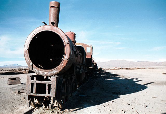
The antique train cemetery is located 3 km outside Uyuni and is connected to it by the old train tracks. The town served in the past as a distribution hub for the trains carrying minerals on their way to the Pacific Ocean ports. The train lines were built by British engineers who arrived near the end of the 19th century and formed a sizable community in Uyuni. The rail construction started in 1888 and ended in 1892. In the 1940s, the mining industry collapsed, partly due to the mineral depletion. Many trains were abandoned thereby producing the train cemetery.


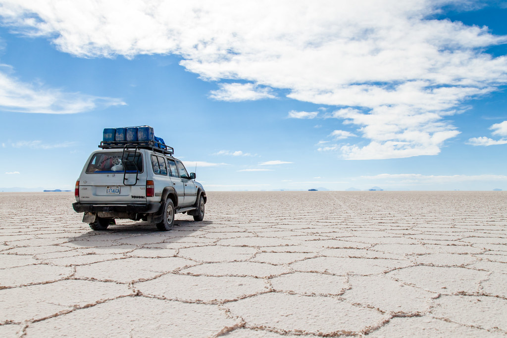
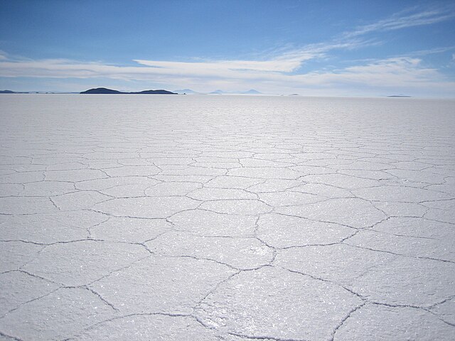
Colchani is a small town near Uyuni, local families process the salt by drying, grounding and adding iodine. Salar de Uyuni is the world's largest salt flat at 10,582 square kilometers (4,086 sq mi). It is located near the crest of the Andes and is at an altitude of 3,656 meters (11,995 ft) above sea level. The Salar was formed as a result of transformations between several prehistoric lakes. It is covered by a few meters of salt crust, which has an extraordinary flatness. The Salar serves as the major transport route across the Bolivian Altiplano and is a major breeding ground for several species of flamingos.


Isla Incahuasi is a hilly and rocky outcrop of land and former island in the middle of Salar de Uyuni, the world's largest salt flat, at an elevation of 3,656 meters (11,995 feet). Isla Incahuasi is the Spanish name where isla means island, Inca stands for Inca, and huasi is derived from the Quechua word wasi meaning house. Incahuasi has a total area of 24.62 hectares (61 acres) and hosts gigantic cacti and a tourist center. The place is the top of the remains of an ancient volcano, which was submerged when the area was part of a giant prehistoric lake, roughly 40,000 years ago.
Uyuni

Chiguana, Nor Lipez, Sur Lipez
Head south into the desert expedition part of the adventure. Passing through the towns of San Juan and Chiguana military post you will enter the desert of Siloli. The desert has many geomorphological formations. It is one of the gateways to the Eduardo Avaroa Andean Fauna National Reserve, and often part of many adventure routes.

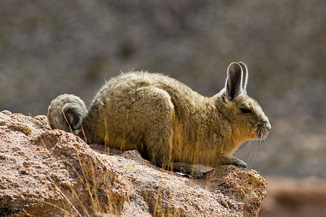
Laguna Hedionda is a saline lake. It is notable for various migratory species of pink and white flamingos. It lies at an altitude of 4,121 metres (13,520 ft), with an area of 3 square kilometres (1.2 sq mi). Salt flats and bofedales (wetlands) are spread over the periphery of the lake. It is in a very remote area where human habitation is negligible. However, llamas and alpacas are seen grazing in the area.

Arbol de Piedra is an isolated rock formation in the Eduardo Avaroa Andean Fauna National Reserve. Much photographed, it projects out of the altiplano sand dunes of Siloli, about 18 kilometres (11 mi) north of Laguna Colorada. Known as the "Stone Tree," it is shaped like a stunted tree about 7 m high. Its shape, particularly the thin stem, are due to strong winds carrying sand and eroding the soft sandstone.

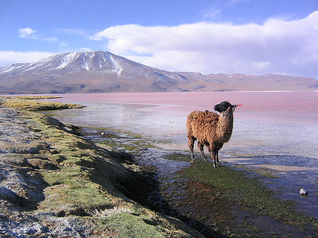
Laguna Colorada (Red Lagoon) is a shallow salt lake in the Eduardo Avaroa Andean Fauna National Reserve and close to the border with Chile. The lake contains borax islands, whose white color contrasts with the reddish color of its waters, which is caused by red sediments and pigmentation of some algae.
Sur Lipez


Sol de Manana, meaning Morning Sun in Spanish, is a geothermal field. It extends over 10 square kilometres. The area is characterized by geothermal activity with many geysers and mud pools. Geysers emit jets of steam and hot water to a height of between 10 m (33 ft) and 50 m (164 ft) in the morning.


Laguna Verde (Spanish for "green lake") is a salt lake in and endorheic basin, in the southwestern Altiplano. It is close to the Chilean border, at the foot of the volcano Licancabur. It has mineral suspensions of arsenic and other minerals which renders colour to the lake waters. Its color varies from turquoise to dark emerald depending on the disturbance caused to sediments in the lake by winds.

Laguna Blanca is located beside Laguna Verde, only a narrow corridor separates it from the smaller Laguna Verde. The characteristic white colour of the water, that gave the lake its name, is caused by the high amount of minerals suspended in it. Typically, after visiting Laguna Verde and Laguna Blanca, next stop is the border transfer for travelers heading to Chile, or return to Uyuni with a stop for lunch.